11.9 Link between Grids and other Domain Objects
| Topic Version | 1 | Published | 09/11/2015 | |
| For Standard | RESQML v2.0.1 | |||
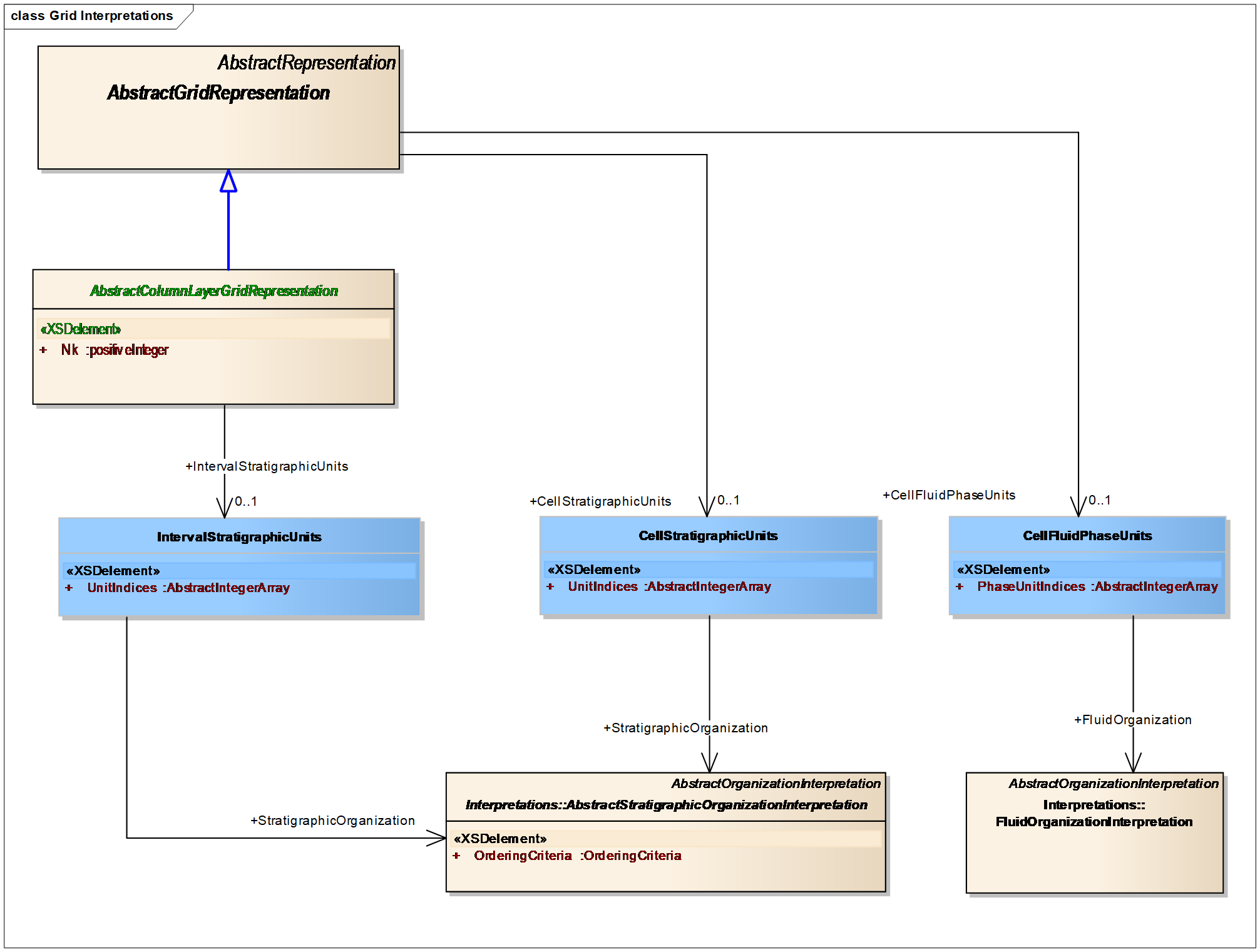
Any RESQML representation, including a grid, may provide a representation of an interpretation of a feature (for more information, see 5 Knowledge Hierarchy : Features, Interpretations, Representations , and Properties ). The most common application of this subsurface knowledge hierarchy is to indicate that different grid representations either share or have disparate interpretations of the features of an earth model, especially the reservoir stratigraphy and its fluid contacts. In addition to the generic relationships common to all RESQML representations, grids support several interpretation objects, which rely on the interval or cell indexing of a grid to provide specific representations for a stratigraphic column or for a fluid phase unit, as shown in Figure 11.9-1 .
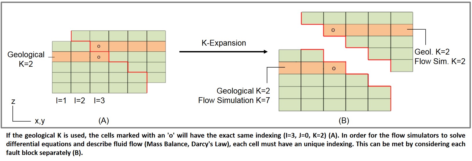
The interval stratigraphic column Interpretation takes advantage of a mapping between the intervals of a grid (layers + gaps) and a stratigraphic column. Implicit in the column are a definition of geologic units and their horizons. Many grids have such a mapping, although exceptions may arise when we attempt to represent complex structures, especially with reverse faults. In such a case, a “K-layer” mapping to a stratigraphic organization may not exist. In this case, a mapping from the grid cells to the stratigraphy is available instead to provide a representation of the stratigraphic column interpretation. Similarly, the cell fluid phase interpretation provides a mapping from grid cells to a fluid organization, which specifies the hydrostatic fluids that are used to fill the model. These element level interpretation objects may also be applied to the intervals or cells of a wellbore frame or of a blocked wellbore. (For more information on wells, see 12 Wells .)
When a given K layer in the grid corresponds to one or several stratigraphic units, the interval stratigraphic units element captures for each K the stratigraphic units associated with this layer. As it is possible for one K to lump together several stratigraphic units, a jagged array is required to capture this association. In a complex case when a single K unit does not follow the stratigraphy, a property with property kind “geologic k“ is used to store indices that are used in the interval stratigraphic units element.
In Figure 11.9-2 , where a K expanded grid is represented, Flow Simulation K is the natural index in the IJK grid, and Geological K will be exported as a property of property kind “geologic k”. This Geological K values are used as array indices for interval stratigraphic units unit indices.