13.3 Seismic Line
| Topic Version | 1 | Published | 09/11/2015 | |
| For Standard | RESQML v2.0.1 | |||
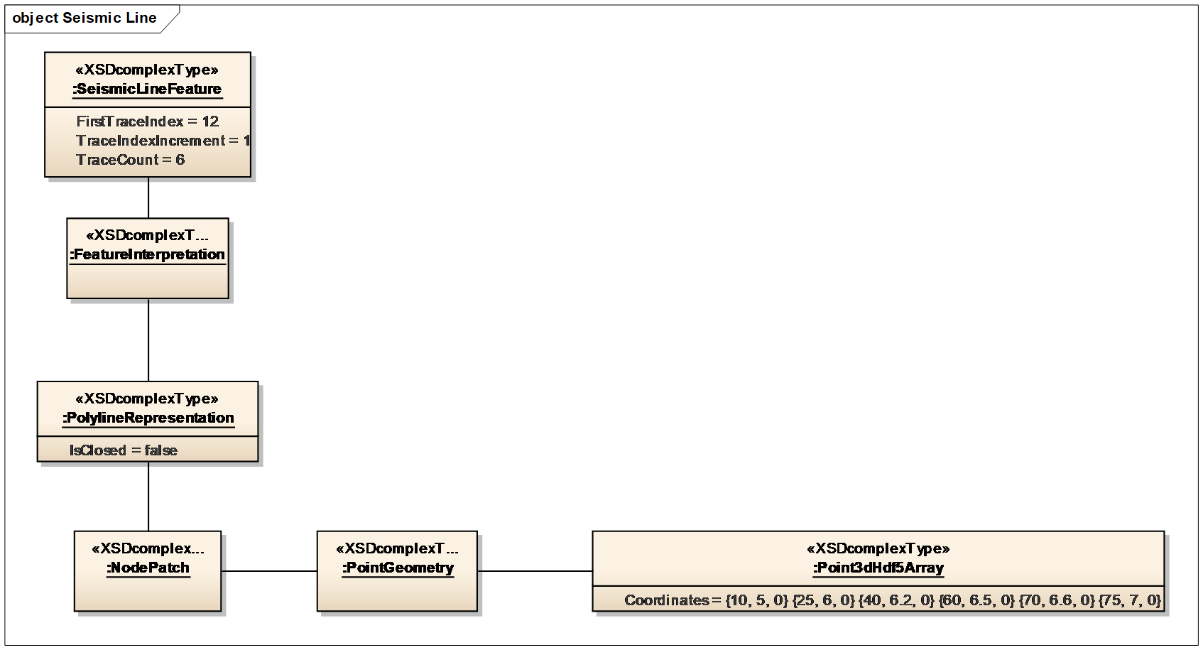
A seismic line defines the seismic common midpoint (CMP) organization for the 2D survey acquisition and processing. It is represented by a polyline (Figure 13.3-1) where each node corresponds to one seismic gather location.
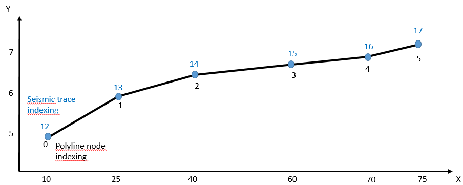
At the feature level, the dimension of a seismic line is the dimension of the seismic traces. The indexing of this dimension must be regularly incremented, but this is the only constraint.
At the representation level, the dimension of a seismic line is geometrically oriented and corresponds to the indexing of the polyline nodes. The indexing of this dimension is very constrained: the origin index is always 0, and the index increment between two nodes is always equal to 1.
Figure 13.3-2 shows how RESQML uses an array of explicit points 3D (ArrayOfExplicitPoints3d) to define the geometry of the representation of the survey.