6.1.2 Geological Interpretation (InterpretedGeologyInterval)
| Topic Version | 1 | Published | 11/11/2016 | |
| For Standard | WITSML v2.0 | |||
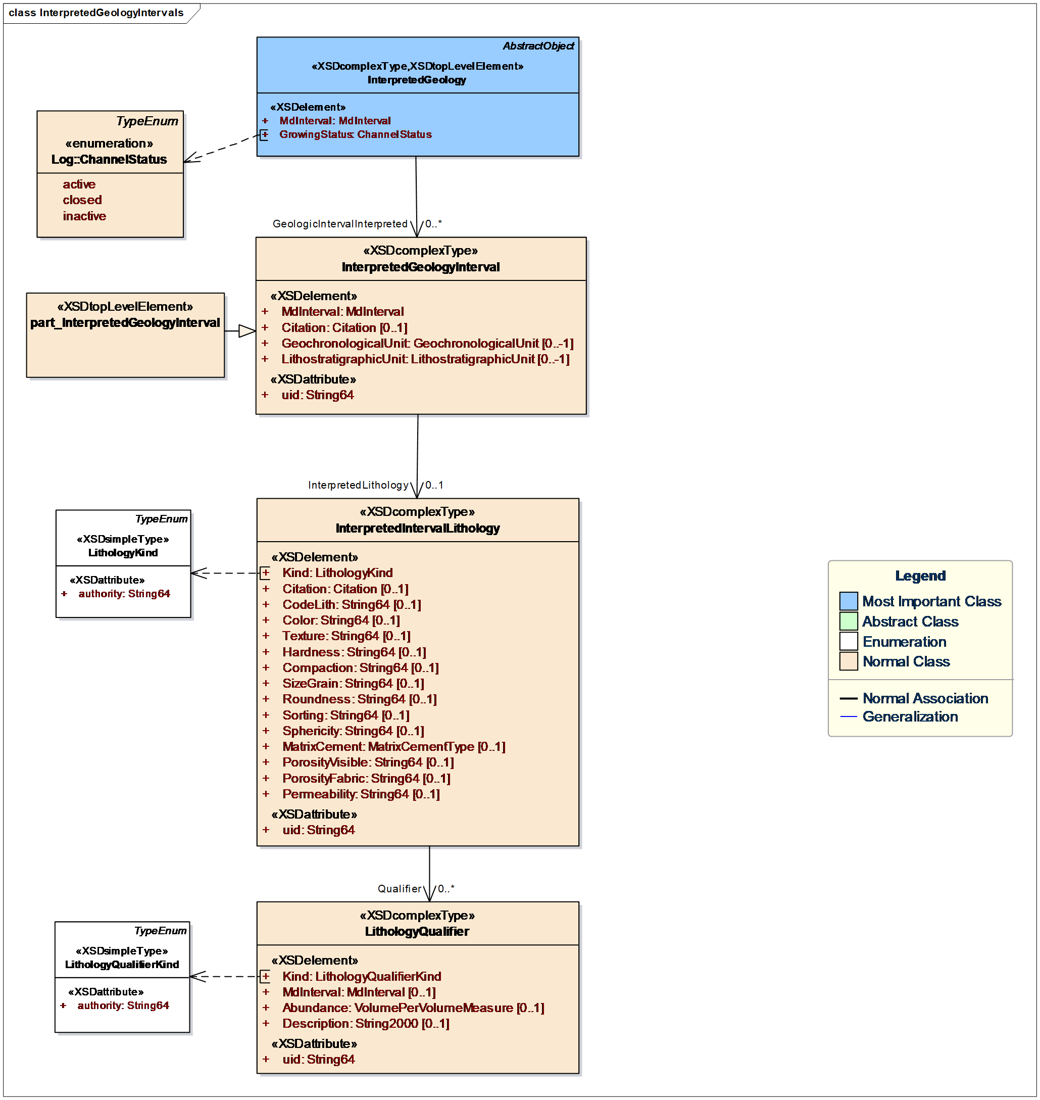
To estimate the location of the boundaries between the different lithology types, the mud logging company and/or a wellsite geologist may then make an interpretation of the actual lithology sequence along the length of the wellbore by correlating the percentage lithologies observed in the cuttings samples with other data, typically the drill rate and gamma ray log curves. This analysis creates a sequence of individual lithologies along the wellbore, which can be represented in WITSML as interpreted geology interval elements (Figure 6.1.2-1), each having a single interpreted interval lithology sub-object that captures the detailed geological description of the lithology.
For realtime streaming of the interpreted lithology, use the part interpreted geology interval object. Create a new object to stream each identified lithological interval.
To present a geological prognosis for the well in a non-realtime environment, use the geochronological unit, lithostratigraphic unit, and interpreted interval lithology objects in multiple instances of interpreted geology interval with either congruent or overlapping depth ranges.