9.2.2.1 Individual Feature Interpretations
| Topic Version | 1 | Published | 09/11/2015 | |
| For Standard | RESQML v2.0.1 | |||
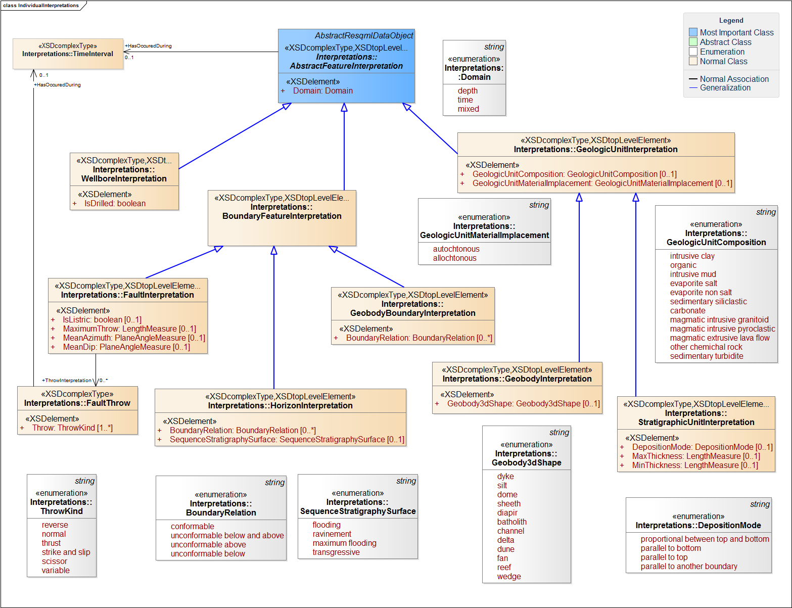
RESQML has these categories of individual interpretation features (Figure 9.2.2.1-1):
- Wellbore interpretation (line). A wellbore feature can contain different wellbore interpretations, which correspond to planned and/or drilled trajectories. A Boolean attribute "isDrilled" is used to indicate drilled versus planned wellbores.
- Boundary interpretation (surface). A boundary interpretation may be one of these kinds: fault, horizon, or geobody boundary. Each of these has characteristics (enumerations) which may influence how its representation is built.
- Geologic unit interpretation (volume). A geologic unit interpretation can be allochtonous or autochtonous and knowledge of its composition can help the user determine how to model it. RESQML geologic units have these two main categories and the following specific values:
- Geobody interpretation, which can have these 3D shapes: dyke, silt, dome, sheeth, diaper, batholith, channel, delta, dune, fan, reef, wedge
- Stratigraphic unit, which can have these deposition modes:
-
-
- Proportional between top and bottom
- Parallel to bottom
- Parallel to top
- Parallel to another boundary
-
9.2.2.2 Contact Interpretations 9.2.2.3 Organization Interpretations .