13.6.1 Use Case
| Topic Version | 1 | Published | 09/11/2015 | |
| For Standard | RESQML v2.0.1 | |||
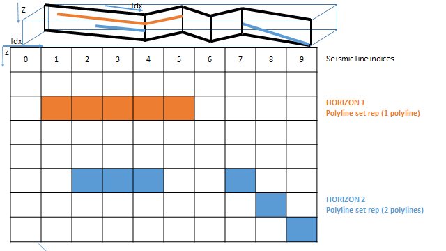
- User exports the seismic line structure: topographic line or polyline from Software A ( Figure 13.6.1-1 , Horizon 1).
- Based on this structure, user also exports seismic picked (potentially tracked as well) horizons by means of polyline defined by X, Y, Z coordinates + seismic 2Dcoordinates ( Figure 13.6.1-1 , Horizon 2).
- Import those data in Software B.
There are two scenarios of interpretation on a 2D seismic line (which are both explained below):